


Drainage planning with GPS data
Drainage systems have to function faultlessly. Therefore, drainage planning is always preceded by field studies, so that we can precisely determine the local soil structure, moisture and other conditions.
Based on this information, we put together the adapted drainage system and complete the plan with the use of GPS (Global Positioning System). All our drainage systems are thus based on exact positioning information and can be precisely dimensioned even over large distances.
View picture: Drainage plan – prepared using GPS data
The data are first saved onto a handheld PC via a GPS receiver. In the office, we then load the data onto our computers before we process the data for the drainage system and the lengths for collectors and drains using the ArcView.
If you wish, we can save your GPS data and drainage plans onto a CD and deliver them to you along with the printouts. That way, you can look at your plans in your field records and store them there. Copies of our customers’ drainage plans are also usually stored in our own data archiving system.
Services & Benefits

Planning Präziser Dränageplan mit Hilfe von GPS für eine exakte Positionsbestimmung. read more...

Increased yields Mit einer Dränung erreichen Sie Erstragssteigerungen bis zu 100%. read more...
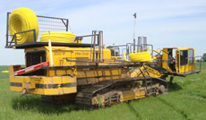
Drainage installation Verlegung/ Installation von Drainagen auf landwirtschaftlichen Flächen. read more...